Few walks weave the beauty of the Yorkshire countryside and classic, beloved literature together quite as seamlessly as the Brontë Falls and Top Withens route from Haworth. Here, on the edge of the Pennine moors, one of the county’s most picturesque villages gives way to the wildness of the moors, where sweeping heather covers the ground, waterfalls tumble through wooded valleys, and a solitary ruin stands against the skyline, long associated with one of the greatest novels in the English language.
This is a walk through the heart of Brontë country. Beginning in the village where the sisters lived and wrote, the route climbs steadily past places they once roamed, passing the Brontë waterfalls before crossing the moorland to reach Top Withens, widely believed to have inspired Wuthering Heights.

More powerful than any single building is the landscape itself. For Emily Brontë, the moors surrounding Haworth were both playground and refuge. She walked daily, often alone, developing an intimate familiarity with their ever-changing atmosphere.
The emotional landscape of Wuthering Heights mirrors the terrain here: It’s fierce, untamed and shaped by the elements. Wind and weather in the novel are active presences and as much a character as Cathy and Heathcliffe. The same can be said of this stretch of moor. The exposure, the wide horizons and the shifting light lend the walk a sense of drama that matches the novel.
At around seven miles, this circular walk is an ideal half-day hike, mixing steady climbs with unforgettable views. But more than that, it offers context to some of history’s greatest literary works and a chance to see how the moors shaped the imagination of Emily Brontë and her sisters.
Where is Haworth & How do you Get There?
You’ll find the village of Haworth perched on the edge of the South Pennines in West Yorkshire. While it seems remote, it is close enough to some major Yorkshire cities to make it an easy day trip. However, it is surrounded by open moorland that gives it a sense of literary isolation. Best known as the home of the Brontë sisters, the village sits above the Worth Valley, its stone cottages and steep cobbled Main Street leading up towards the moors that inspired Wuthering Heights.


Location and Overview
You’ll find Haworth in West Yorkshire. It’s close to several major cities:
- 10 miles (16km) west of Bradford
- 10 miles (16km) south-west of Keighley
- 20 miles (32km) west of Leeds
- 30 miles (48km) north-east of Manchester
The village sits on a hillside at the edge of the Pennine moors, overlooking the Worth Valley. Its elevated position means you’re only minutes from open countryside, a landscape that inspired the Brontes writing and one of the reasons their work was so closely connected to the surrounding moorland.
The heart of the village is compact and easily walkable, centred around the steep and hilly Main Street with the Brontë Parsonage Museum at its top.
Getting to Haworth by Car
Driving is the simplest way to reach Haworth, particularly if you’re planning to walk the Brontë Falls and Top Withens circular route.
From Leeds or Bradford, take the A650 towards Keighley, then follow the signs for Haworth.
From Manchester, take the M62 eastbound, exit at junction 24 or 25, and follow local routes via Halifax or Keighley.
There’s ample parking in the village, with multiple pay-and-display car parks, but I would advise arriving early, as these can fill quickly, especially on weekends.
Getting to Haworth by Public Transport
Haworth is well connected by train and bus, though journeys require a short onward connection from nearby towns.
By Train
The nearest mainline station is Keighley, with regular services from Leeds, Bradford and Skipton. From Keighley, local buses run to Haworth in around 20–25 minutes.

Alternatively, to start your day out in a more extravagant and exciting way, you can travel on the heritage Keighley and Worth Valley Railway from Keighley to Haworth. It’s a scenic steam railway that adds a touch of nostalgia to your visit.
By Bus
Regular bus services connect Haworth with Keighley, Bradford and Halifax. Services are more frequent on weekdays and Saturdays, with reduced timetables on Sundays. When travelling from Manchester, Leeds or any other major cities, it is best to connect via Bradford.
While public transport is entirely feasible for a day trip, it’s worth checking return times carefully, particularly in winter, to ensure you’re not rushing back from the moors to catch the last service.
Walk Overview: Bronte Falls & Top Withens Circular Route
The Bronte Falls and Top Withens circular walk is a classic Haworth route: It’s a sweeping loop that climbs from the village’s cobbled lanes into open moorland, passing tumbling waterfalls and culminates at one of Yorkshire’s most storied ruins. Starting and finishing in Haworth, the walk combines literary heritage with beautiful, big-sky Pennine scenery.
Quick Facts
- Location: Haworth, West Yorkshire
- Distance: Approximately 6.5–7 miles (10–11km), depending on your chosen variation
- Time: 3–4 hours at a steady pace, allowing for stops
- Elevation Gain: Around 250–300 metres
- Difficulty: Moderate
While there are no technical sections, the route includes sustained climbs and exposed stretches across open moorland. A reasonable level of fitness is required, particularly for the ascent beyond Bronte Falls towards Top Withens.
Route Summary
From Haworth’s steep Main Street, the path heads out towards Penistone Hill Country Park before descending gently into the wooded valley that leads to Bronte Falls. After crossing the footbridge and stepping stones, the route begins its steady climb onto the open moor.

The landscape quickly moves from a sheltered valley to a wide, windswept plateau. A stone-pitched path guides you across heather-clad terrain towards Top Withens, the isolated ruin long associated with Wuthering Heights. From here, the circular route loops back via Stanbury Moor (or alternative marked paths), gradually descending towards Haworth with expansive views over the Worth Valley.
The Haworth to Top Withens Circular Route: Step-by-Step
Although the goal of this hike is to reach Top Withens, the start and end point in the hilltop village of Haworth is as evocative as anything you will find along the way. Before you step onto the moor, you’ll walk the same cobbles that have been trodden for centuries, and most importantly, trace the footsteps of three of England’s most celebrated writers. Beginning here adds depth to the Brontë Falls and Top Withens circular walk, and adds context to this literary pilgrimage.
Starting Point: Haworth & the Brontë Parsonage
Most people start on Haworth’s Main Street, lined with quaint stone cottages, independent shops and traditional pubs, rising towards the churchyard at the top of the hill. Here you’ll find the Brontë Parsonage Museum, the former family home of the Brontës and now one of Yorkshire’s most important literary landmarks.
Even if you don’t plan to go inside (although it definitely deserves a visit), it’s worth pausing in the churchyard to take in the setting. Behind the parsonage, the land rises quickly into open moor, which you’ll soon be walking into. From here, the route typically heads out towards Penistone Hill Country Park, following signposted footpaths that lead away from the village and into the Worth Valley.


If you’re driving, you can park in one of the village pay-and-display car parks near Main Street or closer to the parsonage. Alternatively, parking at Penistone Hill reduces the length of the walk slightly and avoids the initial steep climb from the centre.
Facilities, such as cafés, bakeries, pubs and toilets, are all concentrated in the village, so this is the place to stock up before setting off. Once you leave Haworth behind, the landscape quickly becomes rural and remote.
Literary Context: The Brontës in Haworth
Although you don’t necessarily need to understand the Brontës to walk these moors, a knowledge of the family and their connection to the area really enhances the experience.
In 1820, Patrick Brontë moved his family to Haworth from the Bradford suburb of Thornton, when he was appointed perpetual curate of the local parish. The parsonage became home to him and his family, most notably his daughters, Charlotte Brontë, Emily Brontë and Anne Brontë, who would go on to produce some of the most enduring novels in English literature.

It was here that Charlotte wrote Jane Eyre, Emily penned Wuthering Heights, and Anne completed The Tenant of Wildfell Hall. All three sisters drew inspiration from the landscape that surrounded the parsonage.
The moors were a daily presence and the sisters walked them frequently, sometimes together, but often alone. For Emily in particular, the open expanses offered freedom and imaginative space. The wildness, isolation and drama of the Pennine landscape echo powerfully through Wuthering Heights.
Standing outside the parsonage, you can see how immediate that influence must have been. Rather than there being a gradual transition from the village to the countryside the moor almost begins almost at the garden wall. When you set off on the path towards Bronte Falls and Top Withens, you are quite literally following in their footsteps, wandering through the same valleys and paths that shaped their stories.
Section One: Haworth to Bronte Falls (Bronte Waterfall Walk)
The opening stretch of the Bronte Falls and Top Withens circular walk eases you in fairly gently, taking you from the village charm into open countryside. This first section, from Haworth to Bronte Falls, is one of the most accessible and popular parts of the route, offering grand scenery almost immediately, as well as a strong sense of atmosphere without the commitment of the full moorland climb. If you don’t want to do the entire trek, this section can be done as a walk in itself.


Through the Valley to Bronte Falls
Leaving Haworth, most walkers start at the Parsonage Museum and head out of the village via the signposted footpaths towards Penistone Hill Country Park. After a short walk along the main road, the path gradually climbs away from the village before levelling out and curving towards the Worth Valley. Looking back, you’ll see Haworth’s stone houses stacked against the hillside; ahead, the land begins to open up.
Although a big part of the section involves walking along the road towards the country park, you’ll soon find yourself on a footpath that descends into a wooded valley, where the air feels cooler, and the soundscape changes from wind to running water. Here, the terrain becomes more sheltered and green, with trees lining the beck and moss edging the stone walls. The descent is steady but manageable, following a clear, well-trodden path.

As you approach Bronte Falls, you’ll generally hear it before you see it. At the bottom of the valley, water tumbles over a series of rocky steps into shallow pools below. After rainfall, the cascade is quite dramatic while in summer and during drier spells, it becomes much gentler. A simple stone footbridge crosses the beck just below the falls, and stepping stones nearby offer a fun way of crossing when water levels aren’t too high.
This is a good stopping point for a break. Families or people hiking with young children often turn back here but enches and flat rocks provide space to rest, refuel and take photographs. Beyond this point, the route becomes wilder as it climbs towards the moor.
The Brontës & Bronte Waterfall
As the name suggests, the Brontë Waterfalls are widely associated with the Brontë sisters, who are known to have walked extensively in the surrounding countryside. While there’s no formal record of this exact spot being a favourite of theirs, it sits within the landscape that shaped their daily lives, and they would have spent time here.

This is especially true for Emily Brontë; the moors shaped her writing, from the shifting weather, the solitude, and the interplay of water and stone all find their way onto the pages of Wuthering Heights. Though the novel’s setting is fictional, its emotional weather feels inseparable from the landscape.
Section Two: Climbing to Top Withens
The walk to the Brontë waterfalls almost feels like a gentle prologue, while the climb to Top Withens is the dramatic heart of the story. Leaving the shelter of the valley behind, you step fully onto the open moor. This is where the Bronte Falls and Top Withens circular route becomes wilder, more elemental and unmistakably literary.
The Ascent Across the Moor
From Bronte Falls, cross the river by the stone bridge and join the path at the other side of the valley that begins a steady climb that continues almost all the way to Top Withens. It’s paved in places, with stone-pitched slabs laid across the ground, guiding you through the peat and heather. In places, the gradient sharpens, but it is rarely too steep, and no points require scrambling; it’s just a sustained ascent.

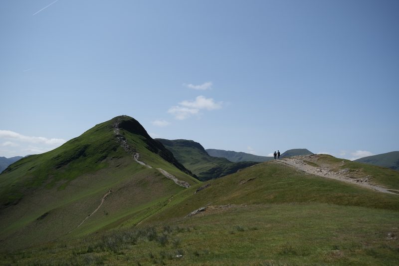
As you continue, the landscape opens wider. The wooded valley recedes, replaced by rolling swathes of moorland stretching towards the horizon. On clear days, you can see across the Worth Valley and beyond; on overcast afternoons, cloud shadows drift over the hills, changing the colours from russet to deep green in seconds.

There is almost no shelter once you leave the valley floor, and the sense of exposure grows the higher you climb. Sheep graze along dry-stone walls, and grouse call out from the shrubs, often rising suddenly from the grass, adding a soundtrack to the solitude.
Eventually, the shape of Top Withens comes into focus and can be seen from a distance, first as a dark line on the skyline, then as a distinct collection of stone ruins standing alone against the moor.
Top Withens: The Real Wuthering Heights?
Is Top Withens truly the model for Wuthering Heights? The question lingers as persistently. It isn’t a particularly impressive sight: The ruin itself is a former farmhouse, likely dating from the late 16th or early 17th century. Today it stands roofless, its thick stone walls framing empty windows and open sky. A plaque at the site acknowledges its association with the novel, and over time, it has become inseparable in the public imagination from the Earnshaw home.

Yet there is no definitive proof that Emily Brontë based Wuthering Heights on this specific building. The architectural details described in the book do not really match the structure as it stands, and alterations were made after Emily’s lifetime. Many scholars believe the fictional house was likely a composite, inspired by several local farmhouses and the broader moorland setting rather than one exact location.


Still, it’s hard to stand here and not feel the connection. The isolation is striking. There are no neighbouring buildings and no nearby roads, just rolling hills and open fields. The building appears braced against the elements. In stormy weather, especially, the resemblance to the novel’s tempestuous atmosphere feels almost uncanny.
Completing the Circular Walk Back to Haworth
After a break at Top Withens, the hardest climbing is behind you, and the walk back is a little more reflective than strenuous as the route begins to arc back towards Haworth, moving from stark isolation to a gradual re-entry into village life.
Leaving Top Withens
From the ruin, the path continues across open moorland before curving towards Stanbury Moor. Waymarked trails guide you along a broad track, often bordered by dry-stone walls. The terrain here is relatively flat, rolling and undulating rather than hilly, offering a gentler walk after the ascent.

Across Stanbury Moor
This stretch can feel particularly atmospheric in changing weather. Cloud shadows sweep across the hills, and the wind carries uninterrupted across the plateau. In late summer, heather washes the landscape purple; in winter, frost and snow make it feel bleak. On clear days, the views stretch widely across the Worth Valley and towards distant Pennine ridges.


The route remains straightforward in good visibility, with signposts regularly appearing to guide your way. However, as with the outward route, fog can obscure landmarks. Keeping to the main, well-worn track will gradually guide you downhill towards Penistone Hill Country Park.
The Descent Towards Haworth
As you begin descending, Haworth slowly reappears in the distance as a cluster of stone buildings, then as a recognisable village perched on its hillside. The return path eventually reconnects with earlier tracks, bringing you back towards the edge of the village.
The shift from open moor to defined paths and walls feels almost theatrical. After hours of wind and openfields, it’s nice to be back in the shelter of the village with the scent of woodsmoke filling the air in the cooler months, and bustling pub beer gardens in summer.
Thankfully, there are plenty of spots in Haworth to wind down after the walk. Many walkers choose to mark the end of the route with a pint or coffee stop along Main Street, or by stepping inside the Brontë Parsonage Museum if they didn’t pop in before beginning the walk. After tracing the contours of the moor, seeing the rooms where the novels were written adds a final layer of perspective.
Practical Tips for Walking the Bronte Falls & Top Withens Circular
The Bronte Falls and Top Withens circular walk may follow a well-trodden path, but it still passes through open moorland, which can be exposed, with changeable weather conditions and is often wilder than it appears.
Check the weather
As mentioned above, the moors surrounding Haworth are notoriously changeable. Even if it seems sunny in the village, the hillsides can be windswept, with low cloud or even horizontal rain higher up. Because much of the route, especially between Brontë Falls and Top Withens, is out in the open, there’s very little shelter.
On clear days, finding your way can be pretty straightforward. However, in fog or snow, the landscape can become disorientating surprisingly quickly. Check the forecast before setting off and avoid the highest sections in severe wind or poor visibility.
What to Bring
This is not necessarily the kind of walk you want to be doing in trainers and jeans, particularly outside high summer. The trail is mostly made up of stone-pitched paths and uneven ground that can become muddy or boggy. As such, you need to dress appropriately. Waterproof walking boots with decent grip are strongly recommended. After wet weather, parts of the climb towards Top Withens can become slippery underfoot.
Backpack Essentials
A small daypack is more than enough for the entire Top Withens circular, but it should comfortably carry:
- Water (there are no reliable refill points or places to buy drinks on the route)
- Snacks or a light lunch
- A waterproof layer
- Sunscreen and sunglasses in summer
- A hat and gloves outside of high summer
In cooler months, adding a spare warm layer is a good idea, especially if you plan to spend an extended amount of time at Top Withens.
There are no cafés, toilets or facilities once you leave Haworth. Stock up in the village before heading out. Even though the route is only 6–7 miles, the steady ascent and exposed conditions can be more tiring than expected. A flask of warming tea or coffee on a blustery day makes the stop at Top Withens far more enjoyable.
Safety & Conservation Notes
While the main paths are clear in good conditions, waymarkers can be sparse, and the moorland tracks intersect in places. An Ordnance Survey map (paper or digital) is advisable, especially if you’re unfamiliar with moorland walking.
Phone signal can be unreliable on higher ground, so download your route in advance rather than relying on data.
The moors are fragile. Stick to established paths to prevent erosion, particularly on the climb to Top Withens. Keep dogs under control around livestock, and take all litter home with you.
Why This Is One of Yorkshire’s Most Atmospheric Walks
If you have spent any amount of time in the Dales and Yorkshire in general, you’ll be aware that there are grander summits in the Pennines and longer routes across West Yorkshire, but few walks manage to combine landscape, literature and atmosphere quite like the circular route from Haworth to Bronte Falls and on to Top Withens.
From the moment you leave the cobbled Main Street and climb towards the open moor, the mood becomes clear. Dry-stone walls give way to wide skies. The land opens, flattens out, and then rises again in slow, sweeping folds. Gusts of wind move through the colourful heather in restless waves. Even on a bright day, there’s a sense of exposure and wildness in a landscape that feels bigger than you.

It’s this elemental quality that makes this particular walk so distinctive and popular. The moors above Haworth are rugged, weather-shaped and largely unchanged in character since the 19th century. These are the same expanses that Emily Brontë walked daily, drawing inspiration for Wuthering Heights. The rawness of the setting, as well as the isolation, the wind, the shifting light seep into the novel’s emotional intensity.
In a way, it’s that interplay between beauty and bleakness that sets this route apart. On a still summer evening, the moors glow gold and purple with flowering flora. In autumn, mist pools in the valleys below and the clouds hang low. In winter, frost sharpens every contour. Each season lends the landscape a different mood, but always equally dramatic.
FAQs
Is Top Withens really Wuthering Heights?
The short answer is “probably not”, but it’s the closest real-world contender.
Top Withens is widely believed to have inspired the house in Wuthering Heights, written by Emily Brontë. The ruined farmhouse sits alone on the moor above Haworth, exposed to wind and weather, exactly the kind of dramatic setting described in the novel.

However, there’s no concrete evidence that Emily explicitly based Wuthering Heights on Top Withens. The current structure was altered after her death, and the farmhouse described in the novel is architecturally different. Most literary historians believe it was the landscape itself and the wild Pennine moors surrounding Haworth that inspired the novel more than any single building.
Today, a plaque at the site acknowledges the strong tradition linking it to the book, and for many walkers, standing there in the wind makes the connection feel entirely convincing.
How long is the Bronte Falls and Top Withens circular walk?
The full circular walk from Haworth via Bronte Falls and Top Withens is approximately 6.5 to 7 miles (10–11km), depending on the exact route variation you choose, as there are different paths cutting across the moorland.
Most walkers complete it in 3 to 4 hours, allowing time for photographs, rest stops, and a wander around Top Withens itself. The route includes steady climbs, particularly on the ascent from Bronte Falls to Top Withens, so factor in extra time if walking with children or in muddy conditions.
Is the walk difficult?
The Bronte Falls and Top Withens circular walk is best described as moderate. While there are no technical sections, you can expect steady uphill climbs across open moorland, uneven stone-pitched paths, and Fully exposed terrain with little shelter. While this is fine in good weather, after rain or snow, you can expect the trail to become muddy or boggy in places, making the ascents and descents difficult. My last attempt at this trail was in snowy conditions, and it did make walking difficult, with patches of ice that made walking slow.

A reasonable level of fitness and proper walking boots are recommended. The weather on the moors above Haworth can change quickly, and strong winds are common even in summer.
Is the walk suitable for children?
Older children who are used to walking 6–7 miles should manage the route well, especially if you build in breaks at Bronte Falls and Top Withens. The stepping stones and bridge at the waterfalls add a sense of adventure, while the wide-open moors give them ample space to roam.
However, the climb to Top Withens can feel long and exposed, and there are no facilities once you leave Haworth. For younger children, a shorter walk to Bronte Falls and back may be more suitable.
Can you walk to Top Withens without doing the full circular route?
Yes. Many walkers choose to do an out-and-back route directly from Haworth or from Penistone Hill Country Park.
The most straightforward option is to head out towards Brontë Falls and then continue up to Top Withens, returning the same way. This slightly shortens the overall mileage and makes navigation simpler in poor weather, although it doesn’t take a significant amount of time off the overall trek.
If time is limited, you can also walk only as far as Brontë Falls and return, which is a popular shorter option that still offers a strong sense of the Brontës’ moorland landscape.
Where do you park for the Bronte Falls walk?
If starting in Haworth village, there are several pay-and-display car parks near the centre, within walking distance of the Brontë Parsonage Museum. These are all well signposted when driving into town.
Alternatively, many walkers park at Penistone Hill Country Park, which provides easier access to the moorland paths and avoids the steeper climb from the village centre, cutting the walk duration. Car parks and parking spaces on the road towards the park can become full by mid-morning, so arrive early on weekends and during summer as this is one of the most popular literary walks in West Yorkshire.
When is the best time to walk to Top Withens?
Spring and autumn are arguably the most atmospheric seasons. In late summer, the heather blooms purple across the moors, creating a beautifully dramatic setting worthy of Wuthering Heights. Autumn brings golden light and fewer crowds.
Winter walks can be spectacular but require care: paths may be icy or waterlogged, and fog can descend quickly across the moor, reducing visibility.
For the best balance of scenery and safety, choose a clear, dry day with light winds. Always check the forecast before setting out, as the weather can be quite changeable in this part of Yorkshire.
Are there toilets or cafés on the route?
There are no facilities on the moorland section of the walk. Toilets, cafés and pubs are available in Haworth before and after your walk. Once you leave the village and head towards Bronte Falls, you’ll be in open countryside until you return, so bring water, snacks and anything else you may need.